 Thanks:
  HaHa:
HaHa: 

 Reply With Quote
Shouldnt there be a boat icon to give you reference of where the fish are located? I would think at 1 o'clock. Since there is no icon. Just guessing here. But I will soon be investing in 360!!!! Hahahahaha

 Crappie.com 2K Star General

In this 360 image,I drew a sschool of fish ,in yellow at the top outer edge of the 360 range. We're would these fish Acually be in relation to my boat?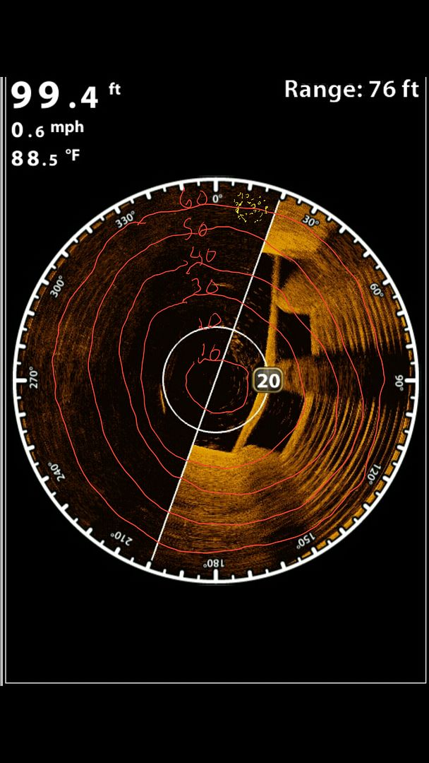
Crappie.com 3K Star General
Shouldnt there be a boat icon to give you reference of where the fish are located? I would think at 1 o'clock. Since there is no icon. Just guessing here. But I will soon be investing in 360!!!! Hahahahaha
Redge LIKED above post
Crappie.com 2K Star General
I drew a boat on this one and also circled the school of fish that I drew on the image.
Last edited by kosmo; 09-22-2016 at 12:18 PM.
Crappie.com 2016 Man of the Year
* Member Sponsor
Notice the water depth in your conclusions guys ...
Rickie
www.podunkideas.com <--Click here
------------
https://www.crappie-gills-n-more.com/
https://cornfieldfishinggear.com/
------------------------>> Pro Staff Sonar Advisor
Crappie.com Legend
I would say 20' deep about 10 to 15' to the right of your boat.
Be safe and good luck fishing
Crappie.com 2K Star General
I drew a second school of fish on the picture,just right of the boat icon. Is it possible that the second school of fish is no farther from the boat,than the first school,that's showing at the top of the scan?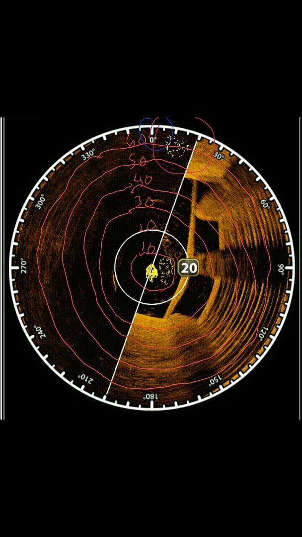
Crappie.com Legend and AL Moderator
* Crappie.com Supporter
I say there is a school close in and one far out . I've had my 360 for two years now and it is a vital part to my fishing. When the fish are schooling I can track them better. Which the ring distance setting dictates where the fish are in reference to the boat.
Crappie.com 2K Star General
There's a fish that I circled to.were is the fish from the boat..?is there anyway to no for sure,we're that fish Acually is?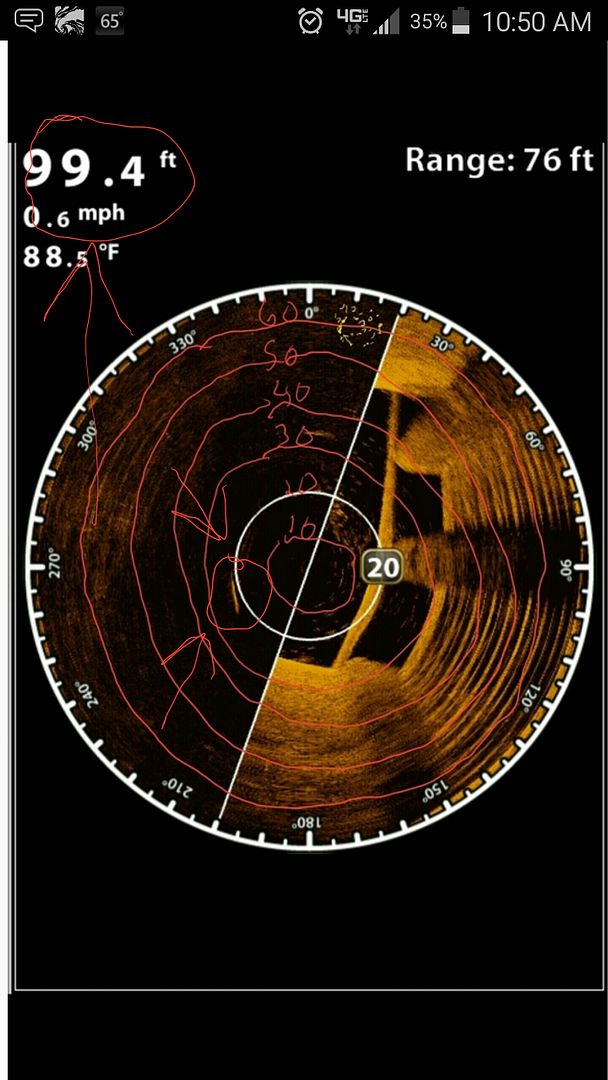
Crappie.com 2K Star General
Ok,here's what I'm thinking about all three that I circled. It's really hard to no for sure if they are under the 360 transducer or out from it.The transducer spinning and pinging.The unit nos the orientation of pings sent and received and time it takes once sent and received back.(The 360 nos,"let's say for an example."a fish is 60ft. but doesn't no if it's 60 ft. down or 60ft.out from the 360) really,the only way to no if the returns down or out from the boat would be see if the returns are showing on 2d. (dam....now I've got myself confused. sorry,I don't no how to explain it any better.)
Crappie.com 2016 Man of the Year
* Member Sponsor
Interesting quiz kos ... Let me see if I can add a different perspective of the data in the 360 image to help some understand what your quiz is depicting ...
-----
-----
We know the 360 image is basically "side imaging with rotating piezoes" ...
So if we manipulate the 360 data and put the available bottom detail into the "history" of an SI image ... the same data (as seen in the 360 image) - would look like the following in SI format ...
We can see that the target in question (fish school) now shows as 60ft Range" from the xducer ...
And because the SI range setting (76ft 360 Range setting as depicted in the 360 image) is less than the water depth (99.4ft as depicted in the 360 image) = there is no bottom detail available in this upper section of the SI image (newer data) when the target (fish school) was in the SI (360) beam ...
Therefore we have no bottom detail in orientation to the target (fish school) to use the target's shadow to determine height of target (fish school) in the water column ...
So as kosmo explained = we cannot determine if the target (fish school) is 60ft away from the boat ... or 60ft under the boat ...
Clear as mud ... ??
Rickie
Last edited by rnvinc; 09-24-2016 at 11:40 AM.
www.podunkideas.com <--Click here
------------
https://www.crappie-gills-n-more.com/
https://cornfieldfishinggear.com/
------------------------>> Pro Staff Sonar Advisor


