Likes:
  Thanks:
  HaHa:
HaHa: 

 Romans 5:8
 Reply With Quote
genec
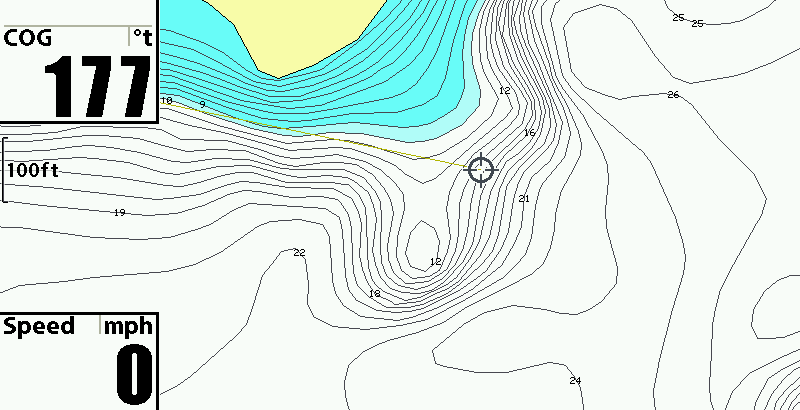
These are some shots in reference to what I found as productive points vs ones that did not produce the size and numbers of gills.
do not reference the cursor as the fishing location (this was just the best fit of the screen for the shot)
When I first started I was just looking for points to scan but found that points with sharp drops left and right and a flat about half way through produced better. These locations needed to show some type of structure, stumps brush ect it seemed to get the most fish to hold as you saw in the earlier SI shots.
These shots show points that match both and the ones I found to be better. The first two show roughly how the slope was compared to the contour map for those that are just learning to use them.
Notice how this point has a slow steady drop going to the end with no flat.
This point has a good drop leading to a flat and a hump at the end. It also had good drop left and right to deeper water.
The following shots show the same and with the aid of the graph up top you will see how to read the contour lines and see the difference in each area. The spots that produced the biggest and most gills were the ones I went over in SI and found a combination of the flat, drops each side and structure. Red/Green showed if I had a gravel or rock bottom that met the mud and silt. Soft bottom points had hardly any fish that I found. Hope it puts ya on some and better help those who asked about this.