
 Likes:
  Thanks:
  HaHa:
HaHa: 


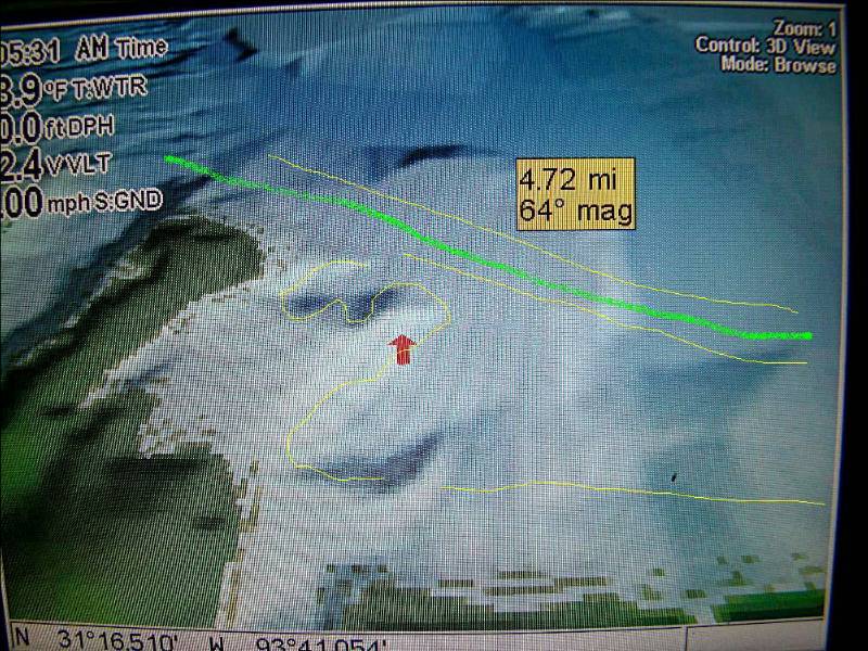
OK what I did was take one of the pics that I posted of this area and now I took it and put some color lines on it to explain it better, I hope.
The yellow lines are the tree lines approximately. The green line is the boat lane. Where you see the red arrow that little peak is a what I call sunken Island. Meaning if the lake is down say 5'-6' there will be an Island showing up with big stumps on some of it. It drops off all around except the left rear where it is sort of a flat with Hydrilla. It drops off to about 25'-30' around it. The tree line at the bottom of the photo is about 21'-22' and dropping off more as you move away from the bottom.
I have fished this spot day and at night for over 38 years so I know if pretty well. The top of this little sunken Island is about 20'-30' wide and about 40'-50' long +-.
Skip
Now the pic all colored up, LOL....

 Reply With Quote


