 Tracks and charting questions
I've been using Autochart to map a local lake. I've noticed these red lines, which I think are tracks, showing everywhere I've been so far.
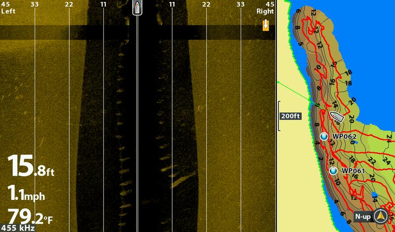
Is there a way to get rid of them when viewing the map screen? I thought I had them turned off but maybe they have to be on to use the Autochart feature on my Helix 10 1st generation? When I view the map view on other lakes that I've fished more, they are nearly solid red in many spots where I fish a lot. My understanding of tracks is so you can run the same route again; re-running a specific route is not something that is important to me.
2nd question is my waypoints do not show up in the Autochart software on my desktop. I've read the manual and I can't figure out how to get them to show up there. They were made while actively charting, I've checked the box in the software to show them but so far, have not been able to make them appear. If someone can help me get them to show up, I'd be much obliged. They show up on the unit as you can see in the picture but while working in the software at home, they are missing.
Yes, I was talking to myself; sometimes even I have to ask for expert advice.

 Likes:
  Thanks:
  HaHa:
HaHa: 


 Reply With Quote


