Reply With Quote
I am one of the lucky ones....I will see this setup in person in the not too distant future....
Tom, you will have a job trying to get Frank & me to understand this stuff..
Where's the cooler?...

 Likes: 0
 Thanks: 0
 HaHa: 0
 Crappie.com 2011 Man of the Year
* Crappie.com Supporter
Crappie.com 2011 Man of the Year
* Crappie.com Supporter

Anyone can set this up. It is not complicated.
How it works:
First, the computer is a Motion Computing LE1600 Tablet with a view anywhere screen. I have a GPS mapping program installed called Oziexplorer. Second, the maps are side scan image maps from Ky Hydrographics. I can load and view any section of KY Lake in my area. The side scan gives excellent underwater details. I can preview the maps, then mark waypoints or create tracks of stuff I want to visit. I then drive up to the stuff using the moving map feature of Oziexplorer (and watch my SONAR). This stuff works like any GPS with map features. A bunch of people use Ky Hydrographics Maps. It is the way to go if you do not hire a guide. Anybody who wants a guide can call my pal Richard Williams. He knows the lake a lot better than I.
The tablet PC receives NEMA data from either the Garmin GPS276C or the Garmin GPS10, depending on what I am doing. It is just a click of a button (touch screen) to change settings. The Pocket PC can also receive NEMA data from the GPSs. It runs a Program called Ozie CE.
The big advantage is the big screen view and the detailed mapping software. I have Garmin Fishing Hotspots. It is not near the program as KY Hydrographics for this area of Ky Lake. I use both programs ( KY Hydro and Fishing Hot Spots) and I can use both on my PC. Again, it depends on my goals for the day. Sometimes my plans work out, sometimes they dont. This stuff just improves my guess work. These programs/features allow me to change tactics while at sea. If you got through the trouble of getting out on the water, then why not give yourself every chance possible. The option door is wide open.
I can make maps with Oziexplorer. If I have a printed map with 2 known waypoints, I can make an pretty accurate map. I can take 997 records, print the recorded view, scan this with my flatbed scanner, then import the scanned area to Oziexplorer and make a map if I want. Nice tool to have in your pocket.
I would like to thank the following for their input on this setup.
Pat Hahs www.kentuckyhydrografx.com/
Des Newman www.oziexplorer.com/
J.M. www.trimble.com
By the way, Trimble makes a GPS that gets to within sub foot range (less than a foot).
My toys are/were gifts. I got friends in high places. I think we call him God.
Tom
Member BS Pro-Staff and Billbob Pro-Staff
Proud Member of Team Geezer... authorized by: billbob and "G"
Crappie.com Legend
* Crappie.com Supporter
I am one of the lucky ones....I will see this setup in person in the not too distant future....
Tom, you will have a job trying to get Frank & me to understand this stuff..
Where's the cooler?...
USS Intrepid CVS-11 Helicopter Squadron-3 1960-1964
When I keep my gratitude higher than my expectations I have a good day
RIP Frank - Crystal is now posting on his behalf.
Don that won,t be any problem for meOriginally Posted by DonG
PROUD MEMBER OF TEAM GEEZER
Super Moderator
That sound awesome Tom. I just have never seen a screen that big on a fishing boat before. Nice job for sure!
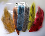
Peak Vise Dealer
Tying Materials, Chenille and Hackle
For Pictures of my Crystal, Nylon/Rayon or
New Age Chenille Please PM Me! Also I
have the Saltwater Neck Hackle and some
colors of Marabou plus other things!
Crappie.com Legend
What did he say??
Tom I think you need to start up the Guide service. So we can book a trip to learn how to use all of ours toys.
Pete
Posting Permissions