Reply With Quote
Mike,
Navionics are by far the better maps. The have more detail and are easier to read. Plus you can use them in Lowrance and Humminbird units. I use the Navionics Premiem SD card. You would need to get the Eastern region for the lakes you want.

 Likes: 0
 Thanks: 0
 HaHa: 0
 Slabmaster II

I had a Lowrance 480 put in the console of my new boat...As I shop Cabela's and Bass Pro for cards I only confuse myself. Can anybody tell me the best card to use...Navionics? Hot Maps? I mainly fish Illinois lakes and Big Sandy in Tennessee. Thanks for any info.
crappieranger
You don't know if you don't go.
Crappie.com 1K Star General
Mike,
Navionics are by far the better maps. The have more detail and are easier to read. Plus you can use them in Lowrance and Humminbird units. I use the Navionics Premiem SD card. You would need to get the Eastern region for the lakes you want.
Have a crappie day!:D [email protected]
Slabmaster II
Thanks, Weezer. I'll check them out.
crappieranger
You don't know if you don't go.
Crappie Wall Hanger II
I have 3 GPS units on my boat and I also have Navionics and Lowrance maps and Lowrance is by far the best map. I bought them both so I could compare. When you zoom in on Nav. maps you loose your contour lines and that is imp. when you following contours. Lowrance maps let you zoom in and keep all your lines all the way. I have the new Low. Pro maps and they are great. I personally advise you to get the Lowrance maps. I have been to several seminars on GPS and sonars and I keep up with all the updates as they come out. Everbody is entitled to their own opinion and that is mine.
Super Moderator
I use Navionics and one is older before they had a premium and I also have the premium with the 1' elevation changes. At times I like either over the other, but if I had to have just one it would be the Premium. I have not had the elevations lines removed as I zoom in, but they do at some point when you zoom out.
possumcop your lines stoop showing as you zoom in closer? Something must be wrong for that to happen because mine are just the opposite and I loose them when I zoom out too far.
If you call Navionics they will email you some screen shots for you to see at different zoom levels.
Last edited by skiptomylu; 04-10-2007 at 06:34 AM.
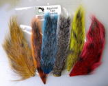
Peak Vise Dealer
Tying Materials, Chenille and Hackle
For Pictures of my Crystal, Nylon/Rayon or
New Age Chenille Please PM Me! Also I
have the Saltwater Neck Hackle and some
colors of Marabou plus other things!
Posting Permissions